Matidor
Map-based platform helping remote teams better visualize, manage, and collaborate on location-based projects and field services.
What is Matidor?
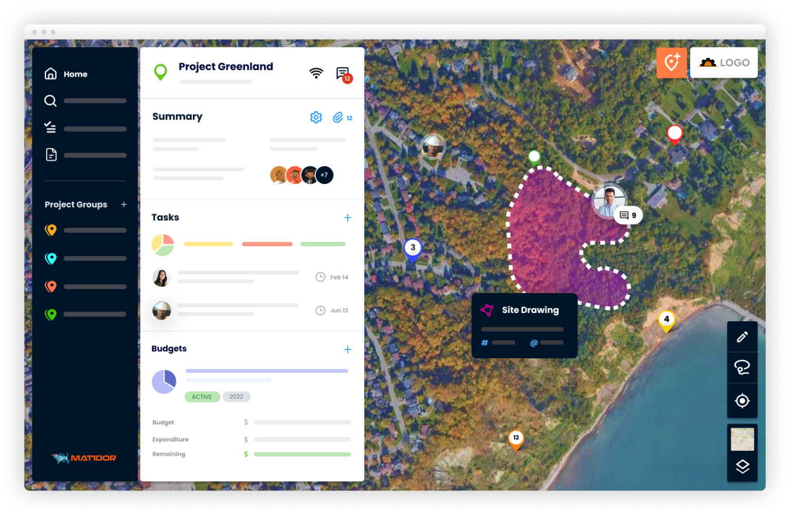
Matidor is a map-based portfolio management platform designed for field professionals. Geospatial and project information relating to physical locations can be readily seen and understood by both technical and business audiences thanks to its intuitiveness and connectivity. Our platform gives companies total visibility over their entire operation portfolio on a map, which can be zoomed in at any time for specific projects site layout, tasks, budgets, expenses, files, and historical details.
Screenshots
Video
Features
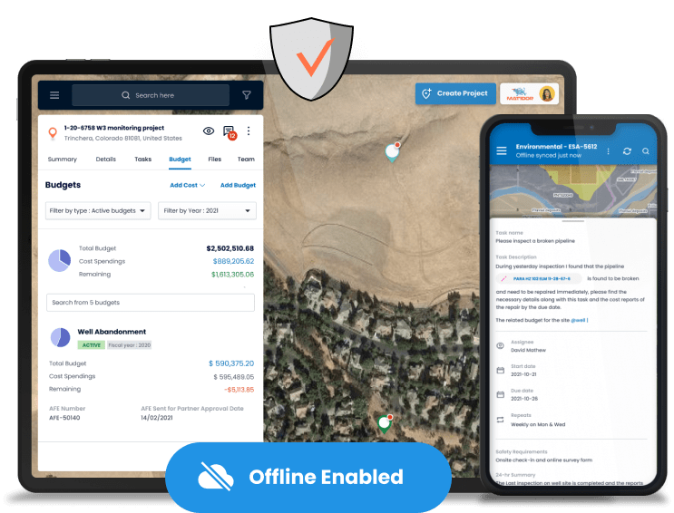
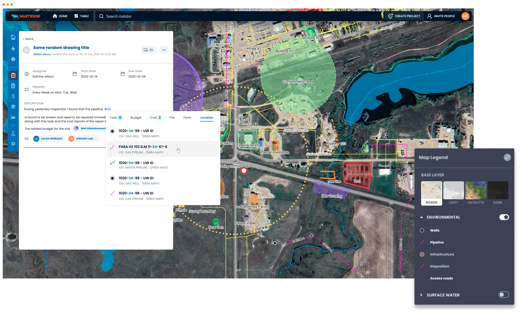
Document Management
Mobile Access
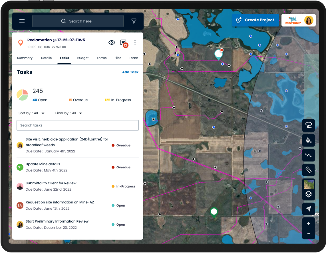
Task Management
Project Management
FAQ
The official website of Matidor is https://matidor.com/
Matidor is a map-based portfolio management platform designed for field professionals. Geospatial and project information relating to physical locations can be readily seen and understood by both technical and business audiences thanks to its intuitiveness and connectivity. Our platform gives companies total visibility over their entire operation portfolio on a map, which can be zoomed in at any time for specific projects site layout, tasks, budgets, expenses, files, and historical details.
Matidor belongs to the Collaboration, Environmental, GIS, Location Intelligence, Oil and Gas category.
Matidor offers features such as Document Management, Mobile Access, Task Management, Project Management.
No, Matidor does not offer a free trial.
Pricing
Starting at:
$1000/per year
Free Trial Available