Mergin Maps
Mergin Maps is a cloud-based GIS solution that helps businesses collect and analyze geospatial field data through mobile devices.
What is Mergin Maps?
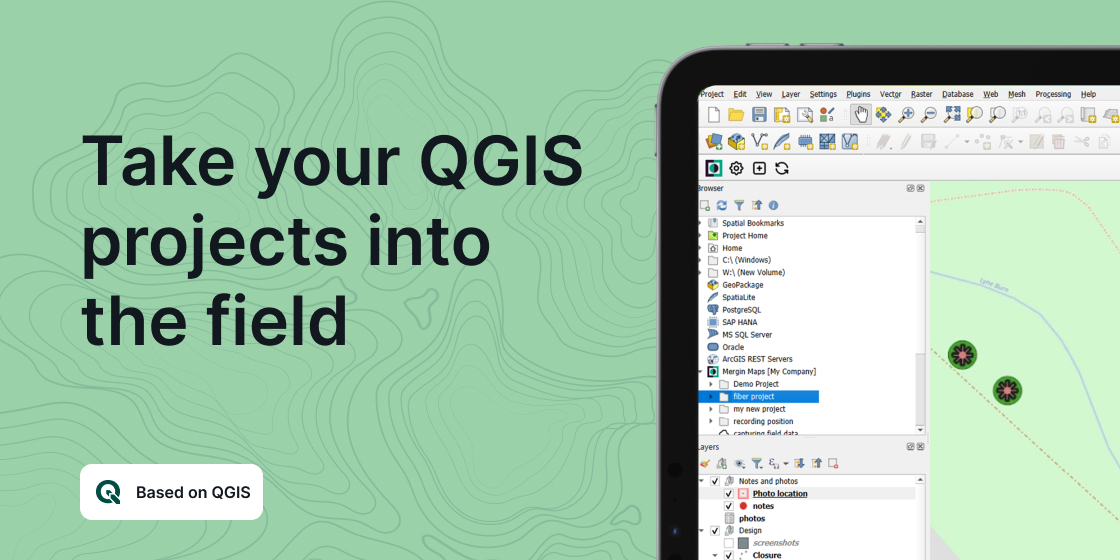
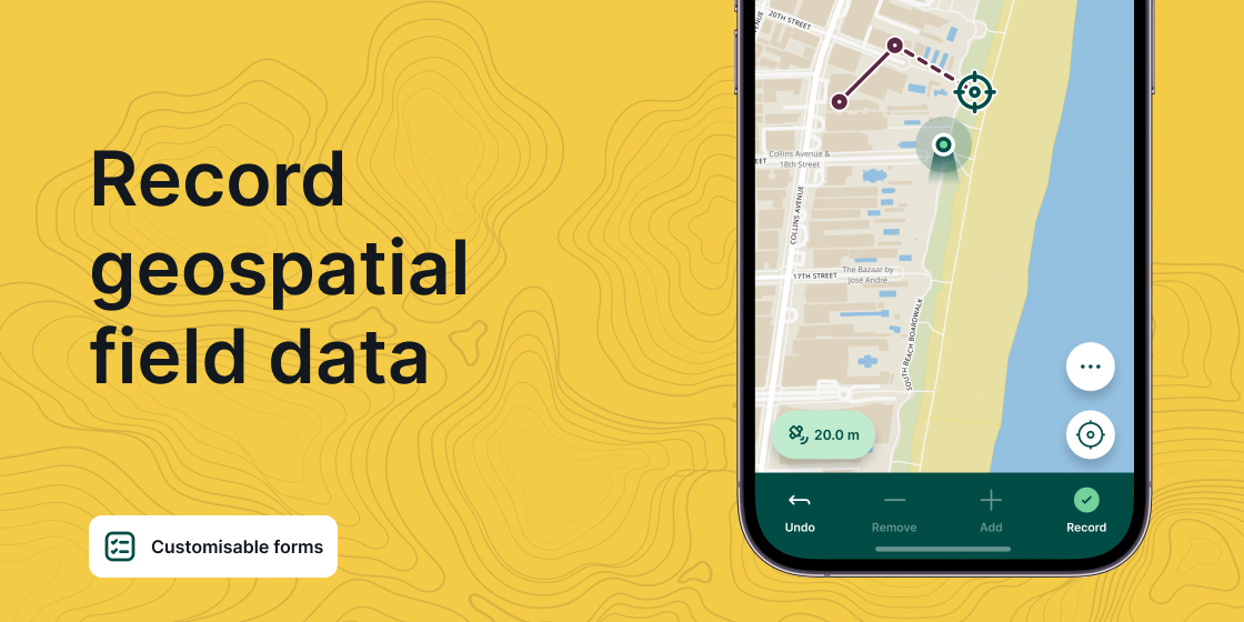
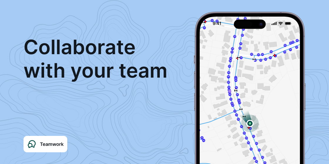
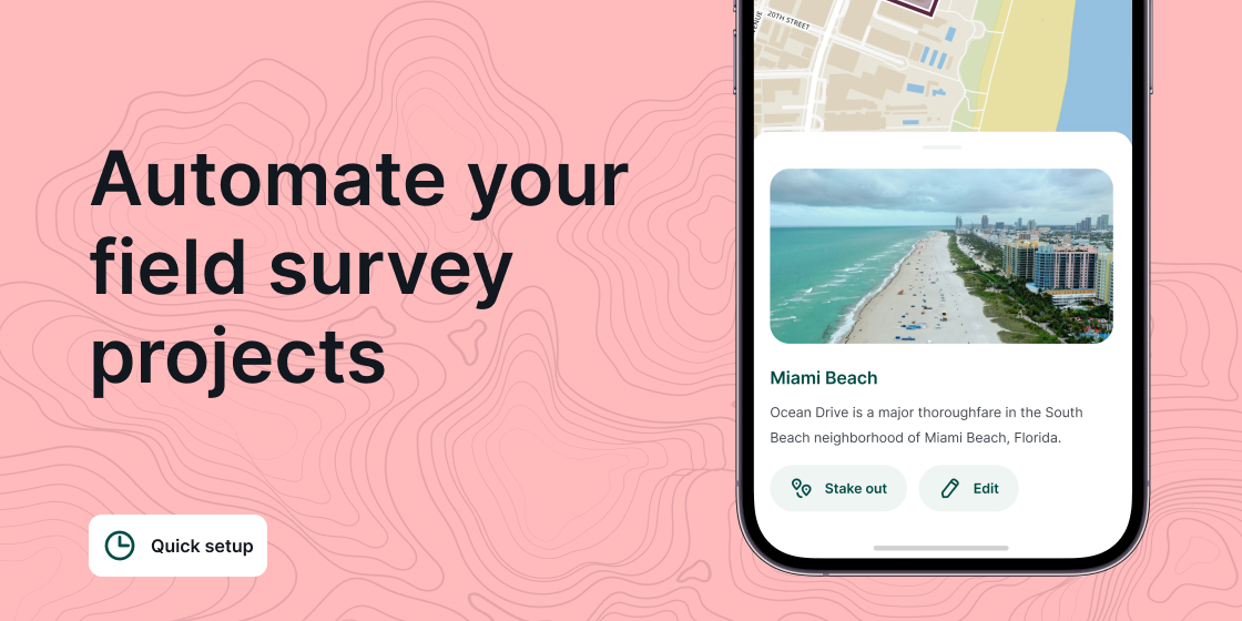
Mergin Maps is a cloud-based GIS solution that helps businesses collect and analyze geospatial field data through mobile devices. The tool allows users to collect points, lines, areas, and photos in the field. Captured data is stored in the cloud, changes are tracked, and updates from multiple users are merged automatically. Mergin Maps allows you to do live position tracking, fill out survey forms and capture and edit points, lines or polygons. You can also connect external GPS/GNSS devices via Bluetooth for high-precision surveying. Map layers look the same as in QGIS desktop so you can set your layer symbology how you want it on the desktop and it will appear that way on your mobile device. Mergin Maps supports offline field data capture for situations where a data connection is unavailable. It can be configured to use either offline or web-based background maps and contextual layers.
Screenshots
Video
Features
FAQ
The official website of Mergin Maps is https://www.lutraconsulting.co.uk/
Mergin Maps is a cloud-based GIS solution that helps businesses collect and analyze geospatial field data through mobile devices. The tool allows users to collect points, lines, areas, and photos in the field. Captured data is stored in the cloud, changes are tracked, and updates from multiple users are merged automatically. Mergin Maps allows you to do live position tracking, fill out survey forms and capture and edit points, lines or polygons. You can also connect external GPS/GNSS devices via Bluetooth for high-precision surveying. Map layers look the same as in QGIS desktop so you can set your layer symbology how you want it on the desktop and it will appear that way on your mobile device. Mergin Maps supports offline field data capture for situations where a data connection is unavailable. It can be configured to use either offline or web-based background maps and contextual layers.
Mergin Maps belongs to the GIS, Location Intelligence category.
Mergin Maps offers features such as Data Import/Export, Data Mapping, Data Visualization, Geotargeting, Location Tracking, Third-Party Integrations.
No, Mergin Maps does not offer a free trial.
Pricing
Starting at:
€11.9/per month
Free Trial Available
Reviews(0)
Write a reviewMergin Maps alternatives
Google Maps
Google Maps is a mapping software that provides users with an interactive map to view locations and directions. The software utilizes satellite imagery, street maps, and 360 panoramic views of streets to display geographic information for over 220 co...load more
Motive
Motive helps businesses manage fleet operations through automated trip logs, GPS tracking, and compliance tools. Most reviews come from small firms, but midsize and enterprise users also cite value in mileage reporting and audit readiness. Historical...load more
EZO
EZO helps small businesses manage inventory and assets across multiple locations, with strong support for check-in/check-out workflows and real-time tracking. Reviewers highlight its ease of use and asset visibility, though some cite UI friction and ...load more
UpKeep
UpKeep is a maintenance management tool mainly used by small businesses in industries such as real estate, food and beverage, and healthcare that need to manage maintenance tasks across multiple sites. Its notable for its mobile-first design and prev...load more
MaintainX
MaintainX is a maintenance management tool used mainly by small businesses in facilities services, automotive, and food and beverage. It stands out for its mobile access and preventive maintenance scheduling, its intuitive interface, and real-time wo...load more
Samsara
Samsara is fleet management software that helps businesses in transportation and construction monitor assets, improve safety, and stay compliant. It stands out for real-time GPS tracking and video-based driver coaching. Users value its intuitive dash...load more
Tango
Tango mission is simple: We make gift cards easy to send and awesome to receive. By bundling easy-to-use technology, desirable incentives, and expert service, we help companies get the most out of their reward and incentive programsrom customer acqui...load more
ArcGIS
Integrated collection of GIS software products; ArcGIS offers unique capabilities and flexible licensing for applying location-based analytics to your business practices. Gain greater insights using contextual tools to visualize and analyze your data...load more
Surfer
Surfer is the most complete platform for AI Search Optimization and visibility. It helps your brand show up where real decisions happenon Google, inside AI-generated answers, and across the web. With Surfer, you create content LLMs want to cite and t...load more
Powerfleet
Powerfleet Unity platform serves as the central command hub for fleet operations, unifying data across assets, drivers, vehicles, and third-party systems. Unity provides real-time visibility, predictive insights, and advanced analytics to optimize fl...load more