RockWorks
Provides geologists and engineers indispensable tools for visualizing their surface and sub-surface data.
What is RockWorks?
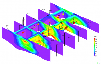
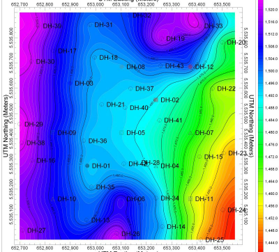
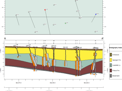
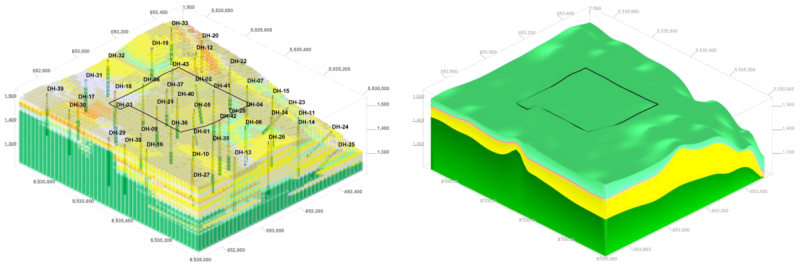
RockWorks is the standard in the petroleum, environmental, geotechnical and mining industries for surface and subsurface data visualization, with tools such as maps, logs, cross sections, fence diagrams, solid models and volume calculations. RockWorks offers options for analyzing your surface and subsurface data, and accepts many different data types, such as stratigraphy, lithology, downhole geochemistry/geophysics/geotechnical measurements, color intervals, fractures, and aquifer data.
Screenshots
Video
Features
3D Imaging
Color Codes/Icons
Data Import/Export
Geocoding
Labeling
Map Sharing
Cross Section Creation
Data Storage Management
FAQ
The official website of RockWorks is http://www.rockware.com/
RockWorks belongs to the GIS, Mining, Oil and Gas category.
RockWorks offers features such as 3D Imaging, Color Codes/Icons, Data Import/Export, Geocoding, Labeling, Map Sharing, Cross Section Creation, Data Storage Management.
No, RockWorks does not offer a free trial.
Pricing
Starting at:
$1500/one time
Free Trial Available