MyGov
The portable online mapping option which allows users to import, export, create, update and use layer information.
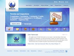
What is MyGov?
Most agencies struggle with easily creating layers and visualizing data with GIS/Mapping which leads to frustration and incomplete information. The module includes features that allow for creating layers, locating assets, mapping activity, visualizing data, and integrating modules. The module will help you to automate systems, collect data, control processes, connect people, enforce regulations, and analyze data.
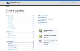
Screenshots
Categories
Features
FAQ
The official website of MyGov is https://www.mygov.us/
Most agencies struggle with easily creating layers and visualizing data with GIS/Mapping which leads to frustration and incomplete information. The module includes features that allow for creating layers, locating assets, mapping activity, visualizing data, and integrating modules. The module will help you to automate systems, collect data, control processes, connect people, enforce regulations, and analyze data.
MyGov belongs to the GIS, Government category.
MyGov offers features such as 3D Imaging, Color Codes/Icons, Data Import/Export, Geocoding, Labeling, Map Sharing, Compliance Management, Inventory Management, Self Service Portal, Work Order Management.
No, MyGov does not offer a free trial.
Pricing
Starting at:
$1260
Free Trial Available
Reviews(0)
Write a reviewMyGov alternatives
Jotform
Jotform helps small teams automate forms and surveys with customizable fields, mobile signatures, and survey logic. Its widely used by administrative roles across nonprofits and education. While PDF formatting and task tracking pose challenges, advan...load more
Google Maps
Google Maps is a mapping software that provides users with an interactive map to view locations and directions. The software utilizes satellite imagery, street maps, and 360 panoramic views of streets to display geographic information for over 220 co...load more
EZO
EZO helps small businesses manage inventory and assets across multiple locations, with strong support for check-in/check-out workflows and real-time tracking. Reviewers highlight its ease of use and asset visibility, though some cite UI friction and ...load more
UpKeep
UpKeep is a maintenance management tool mainly used by small businesses in industries such as real estate, food and beverage, and healthcare that need to manage maintenance tasks across multiple sites. Its notable for its mobile-first design and prev...load more
OnBoard
NOW AVAILABLE: OnBoard AI - The Most Advanced Boardroom AI Available Today OnBoard is the leading board management platform purpose built for today s boardrooms to simplify governance, enhance transparency, and elevate director engagement. Trusted by...load more
MaintainX
MaintainX is a maintenance management tool used mainly by small businesses in facilities services, automotive, and food and beverage. It stands out for its mobile access and preventive maintenance scheduling, its intuitive interface, and real-time wo...load more
Salesforce Service Cloud
Deliver great service and a flexible agent experience, from anywhere. Give agents a holistic view of every customer, whether theyre in the contact center or working remote. Scale and optimise service by leveraging AI and integrating popular support c...load more
NEOGOV
NEOGOV provides a configurable and user-friendly applicant tracking system tailored to meet the unique demands of public sector recruitment. Our solution, Insight, enhances your hiring process by automating key tasks and ensuring compliance. With eas...load more
ArcGIS
Integrated collection of GIS software products; ArcGIS offers unique capabilities and flexible licensing for applying location-based analytics to your business practices. Gain greater insights using contextual tools to visualize and analyze your data...load more
Surfer
Surfer is the most complete platform for AI Search Optimization and visibility. It helps your brand show up where real decisions happenon Google, inside AI-generated answers, and across the web. With Surfer, you create content LLMs want to cite and t...load more