Responder360
Responder360 is a multi-platform application providing unit location tracking, occupancy pre-plan records and CAD details on one screen
What is Responder360?
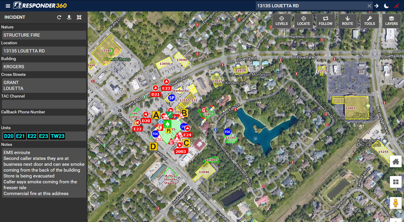
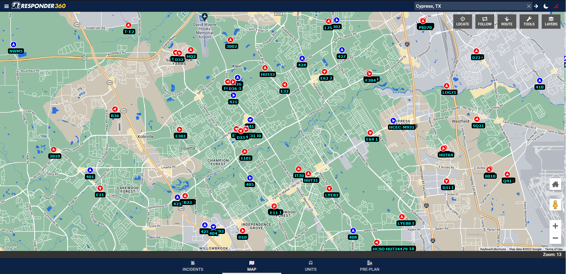
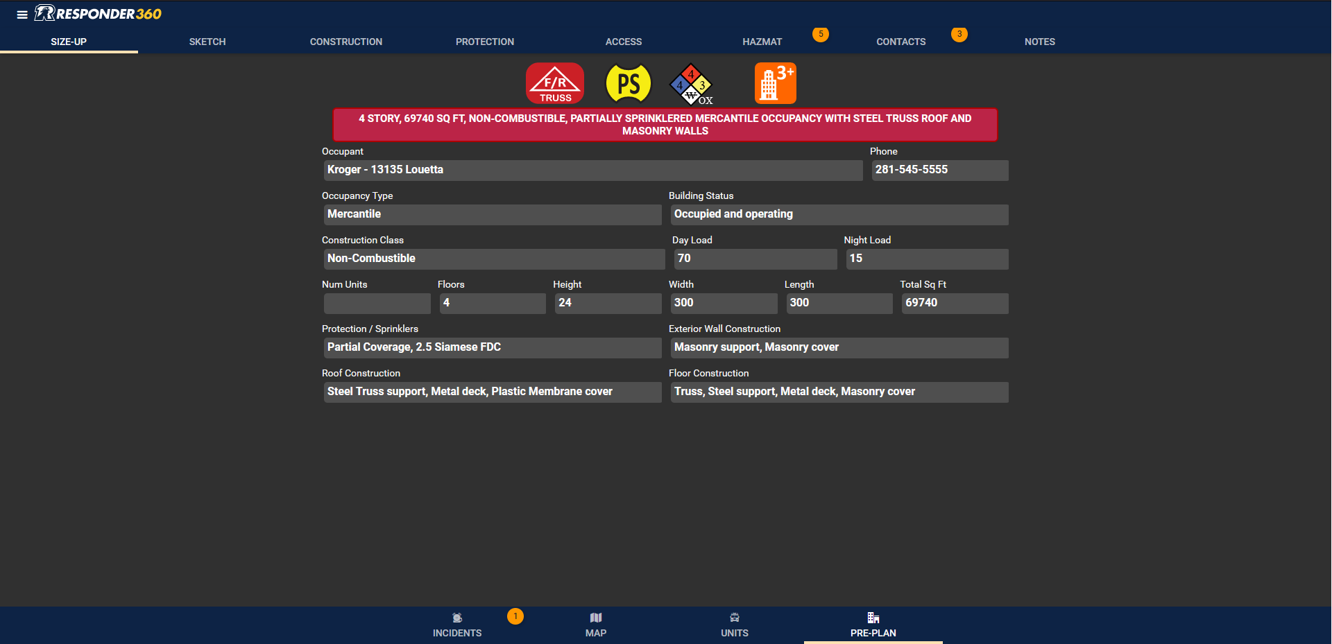
Responder360 provides users with real-time vehicle location information 24/7 for their entire jurisdiction. In addition, the interactive mapping platform provides users with detailed information about the locations they respond to along with NFPA compliant pre-plans on any map layer they desire. These features, combined with an integration to your CAD system, provide a holistic approach to response management that gives all responders with a common operating picture on every incident scene.
Screenshots
Video
Categories
Features
Equipment Tracking
Geographic Maps
Incident Management
FAQ
The official website of Responder360 is https://firstinsoftware.com/
Responder360 provides users with real-time vehicle location information 24/7 for their entire jurisdiction. In addition, the interactive mapping platform provides users with detailed information about the locations they respond to along with NFPA compliant pre-plans on any map layer they desire. These features, combined with an integration to your CAD system, provide a holistic approach to response management that gives all responders with a common operating picture on every incident scene.
Responder360 belongs to the Fire Department category.
Responder360 offers features such as Equipment Tracking, Geographic Maps, Incident Management.
No, Responder360 does not offer a free trial.
Pricing
Starting at:
$2500/per year
Free Trial Available