soft-GIS
Create, Analyze and Visualize directly on the WEB and Mobile. Web and mobile based GIS system with a full set of functionalities.
What is soft-GIS?
soft-GIS a Web and Mobile based GIS ( Geographic Information System ). GIS system with a full set of functionalities ( editing, analyzing, print, plot, etc ) for replacing a classical Desktop GIS systems. soft-GIS is used through a browser on Desktop and Mobile without any installation or plug-in as its architecture is multi-user and easy usable from any devices: just open the link in any browser (desktop or mobile ) and start working.
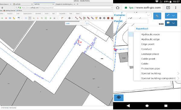
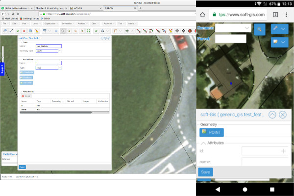
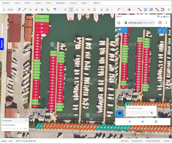
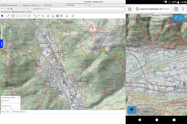
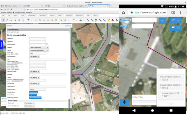
Screenshots
Categories
Features
FAQ
The official website of soft-GIS is https://www.soft-gis.com/
soft-GIS a Web and Mobile based GIS ( Geographic Information System ). GIS system with a full set of functionalities ( editing, analyzing, print, plot, etc ) for replacing a classical Desktop GIS systems. soft-GIS is used through a browser on Desktop and Mobile without any installation or plug-in as its architecture is multi-user and easy usable from any devices: just open the link in any browser (desktop or mobile ) and start working.
soft-GIS belongs to the GIS category.
soft-GIS offers features such as Color Codes/Icons, Data Import/Export, Geocoding, Labeling, Map Sharing.
No, soft-GIS does not offer a free trial.
Pricing
Starting at:
SWISS FRANC (CHF)180/per year
Free Trial Available
Reviews(0)
Write a reviewsoft-GIS alternatives
Google Maps
Google Maps is a mapping software that provides users with an interactive map to view locations and directions. The software utilizes satellite imagery, street maps, and 360 panoramic views of streets to display geographic information for over 220 co...load more
EZO
EZO helps small businesses manage inventory and assets across multiple locations, with strong support for check-in/check-out workflows and real-time tracking. Reviewers highlight its ease of use and asset visibility, though some cite UI friction and ...load more
UpKeep
UpKeep is a maintenance management tool mainly used by small businesses in industries such as real estate, food and beverage, and healthcare that need to manage maintenance tasks across multiple sites. Its notable for its mobile-first design and prev...load more
MaintainX
MaintainX is a maintenance management tool used mainly by small businesses in facilities services, automotive, and food and beverage. It stands out for its mobile access and preventive maintenance scheduling, its intuitive interface, and real-time wo...load more
ArcGIS
Integrated collection of GIS software products; ArcGIS offers unique capabilities and flexible licensing for applying location-based analytics to your business practices. Gain greater insights using contextual tools to visualize and analyze your data...load more
Surfer
Surfer is the most complete platform for AI Search Optimization and visibility. It helps your brand show up where real decisions happenon Google, inside AI-generated answers, and across the web. With Surfer, you create content LLMs want to cite and t...load more
Asset Essentials
Asset Essentials is a cloud-based maintenance solution that generates operational insights from asset and work order management activities. The solution collects and consolidates facility asset data and repair histories, yielding increased asset visi...load more
Fulcrum
Fulcrum is a field-first SaaS platform transforming how organizations manage field data collection and inspections. Designed for the unique challenges of field teams, it automates workflows, captures real-time location data, and integrates seamlessly...load more
MapBusinessOnline
MapBusinessOnline is mapping software for business intelligence. Thousands of businesses choose MapBusinessOnline to generate insightful maps, manage territories, perform market analysis, optimize logistics, and more. MapBusinessOnline addresses all ...load more
BatchGeo
BatchGeo is a web-based tool that helps you quickly and easily create custom maps from your data. Simply copy and paste your spreadsheet or CSV file into BatchGeo, and it will automatically plot your data points onto a map. You can then customize you...load more